Biohistories

Conservation

Identifying habitats and species in Navigator forests

The identification of new habitats and species in Navigator forests has been increasing steadily year on year, thanks to the implementation of the Annual Monitoring Programme. Find out how we carry out this work, which has already identified more than 240 species of fauna and 800 species and subspecies of flora, as well as multiple priority habitats for conservation.

Since it is impossible to survey the whole area in search of the animals and plants that exist there, the identification of habitats and species in Navigator forests is done by sampling, a technique used in most studies and surveys on biodiversity and endangered species, such as Red Lists or Red Books.

Across the approximately 105 thousand hectares of forest owned by the company in Portugal, the first stage of the Monitoring Programme begins with the definition of the sampling areas, i.e. the areas that have the greatest potential in terms of natural values and are therefore a priority for annual sampling.

In order to select these areas, an assessment is made of their natural values based on land cover maps. Areas of natural vegetation are eligible in the first instance and greater priority is given to Navigator’s forest areas that are part of the Portuguese National System of Classified Areas (such as those of the Natura 2000 Network, for example), along with other areas where protected habitats, threatened wildlife species, and rare, endemic, localised, threatened, or endangered flora species have been identified (or potentially exist).

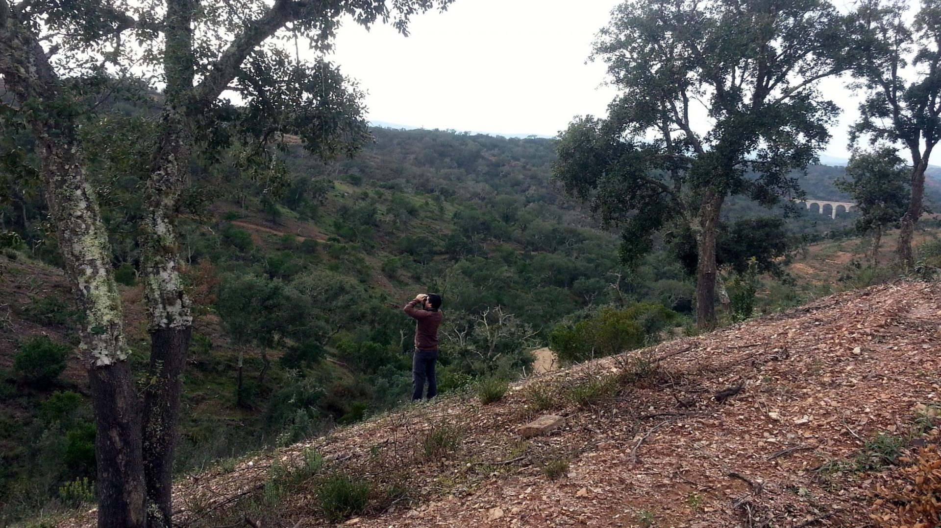
The next step is to evaluate the sampling areas, including the identification of the natural values present therein. The fieldwork is carried out by external partners, namely teams of researchers or specialised companies, using the Rapid Biodiversity Assessment (RBA) method, an approach recognised by the Conventions on Biological Diversity (CBD) of the United Nations and RAMSAR for generating reliable and useful results for ecological conservation over vast areas and in a relatively short period of time.

Imagem-interior-identificar-1

Surveys identifying habitats, wildlife, and flora

The work in the field is carried out by means of specific surveys of the wildlife, plant communities (flora), and habitats:

  • Wildlife

Observation and listening points are set up, and an active search is conducted for animals or signs of their presence, from burrows and nests to droppings. We must be able to recognise these signs, which vary according to the group of animals and between species of the same family.

For example: “Despite being relatively common in Portugal, the Barn Owl (Tyto alba) is a nocturnal bird of prey that cannot always be seen, but is sometimes identified by its regurgitations. They regurgitate the undigested remains of their prey, including fur, bones, and feathers”, explains the survey leader. However, various birds of prey are known to regurgitate their food and to know which species the regurgitation belongs to you need to be able to recognise it, which you can do by looking at elements such as size, colour, roughness, and consistency.

As a result, for each wildlife group, its own methodology is applied and various types of equipment and approaches are used to support the observation and identification of mammals, birds, reptiles, amphibians, and even fish. Heat- and motion-activated cameras, otherwise known as camera traps, are widely used, but this is just one example of many methods used, which, in this case, are used to detect mammals.

  • Flora and natural vegetation

The conservation status of the different patches of natural vegetation, woodland, scrub, grassland, or riparian galleries within the sampling area is assessed. The areas of greatest interest for study are established on the basis of their phytosociological characteristics (characteristics, classification, relationships, and distribution).

Floristic or more accurately phytosociological inventories are then carried out, since they include the abundance, dominance, and associations of flora species, as well as the identification and description of plant communities (and not just the list of plants present).

It was during this work at the Serras do Porto Park that a team from Floradata, a company involved in monitoring natural values in the woodlands managed by Navigator, discovered a specimen of Cheirolophus uliginosus, a little known and “Near Threatened” plant in Portugal. In the Penamacor area, another species was also found, Rhaponticum exaltatum, which had only been previously reported in the north-east of Trás-os-Montes in the Special Area of Conservation of Montesinho/Nogueira, and is considered as “Critically Endangered”.

“Identifying plants and even trees is not always easy because there are many species, subspecies, and hybrids that are the result of cross-breeding. Some are so morphologically similar that it is difficult to differentiate between them in the field. Sometimes, we need to collect samples or photographs in detail so that we can observe them, compare them with the scientific literature, and ask for the help of experts on that species”, explains Nuno Rico.

  • Habitats

Habitats classified under the Habitats Directive are assessed, regardless of whether they are within or outside the boundaries of Special Areas of Conservation of the Natura 2000 Network.

Their conservation status is assessed as a result of the combination of influences affecting them and the characteristic species present, which may affect the natural distribution, structure, functions, and long-term survival.

Imagem-interior-identificar-2

How is information on habitats and species in Navigator Forests used?

The data collected during these activities result in reports and a mapped (geo-referenced) and documented characterisation of the different areas of interest for conservation, their varying requirements and priorities, and a description of the biodiversity of species present in these areas.

This means that the data collected is transformed into information that supports decisions related to forest and biodiversity planning and management. “This has a direct impact on biodiversity conservation in the woodlands managed by Navigator, as well as on other relevant natural resources such as, for example, watercourses and ponds which, besides their importance in terms of being a habitat for wildlife, also generate other important ecosystem services”, explains Nuno Rico.

This information, which is incorporated into Navigator’s Geographical Information System, makes it possible to distinguish between:

  • The different categories of areas of conservation interest;
  • The locations of and information on the habitats classified under the Natura 2000 Network that have already been identified, their conservation status, and their bio-indicator species;
  • The spots where endemic and threatened species can be seen, and the presence of the various types of species on each property.

The assessments also provide information on sensitive areas, such as breeding grounds for species (non-disturbance is essential for reproductive success) and areas with protected or endangered species. In these cases, traditional forestry activities, including land tillage or the use of forestry machinery, will be prohibited or restricted so as not to have a negative impact on nature.

This information is used to define the places that The Navigator Company has designated as Conservation Areas, Protection Areas, or Areas of High Conservation Value, which now total more than 12 thousand hectares. With this knowledge, the most appropriate conservation, protection, mitigation, or restoration strategies for each area are also set out. And just as nature is dynamic, so is this information, because it is being supplemented and adjusted in accordance with regular reassessments as part of the company’s Annual Monitoring Plan.

The mapping and information that is generated is made available to the departments that will design, implement, and manage the forestry projects on the ground, so that they can carry out a prior assessment of the technical, environmental, and social constraints.

The personnel working in these areas receive training on natural values and biodiversity so that they can more readily act in line with the company’s biodiversity conservation strategy. As some of these professionals spend much of their time in the field, they also end up coming across species that have not yet been sighted, which they then record, thus supporting the inventory.

September 2022

Temas: